July 13, 2015
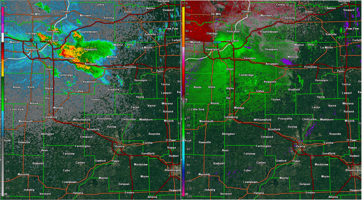
I'm going to apologize upfront, as this post is going to be a whole lot of nothing. However, I feel it is important to hit on both the highs and lows of chasing because it's definitely not all just highs. With the success I’d had the past couple chases, I was very much looking forward to this one. Of course, while working full time and trying to plan a wedding, this set up snuck up on me, so I didn’t have a lot of time to do much of a detailed forecast. What I did know was that an MCS was set to form in the Minnesota and Wisconsin area the previous night and track southeastward across northern Illinois and into Indiana through the early morning hours. As it progressed, it would lay out a boundary across northern and central Illinois, which, when paired with good amounts of shear and ridiculous amounts of CAPE (5,000-6,000 J/kg), would provide a healthy environment for explosive supercell development. Discrete storms were forecast to fire in the mid-to-late afternoon and grow upscale into a strong MCS. I had to work 9am to 6pm, but came in an hour early and skipped lunch in order to get out early. I got off and left around 4pm, heading north toward my target of Peoria, IL. As I neared Springfield, IL, two dominant, discrete storms popped north of me in Illinois and Iowa. The Illinois storm was to the northeast of me near Ottawa, and the other was over Davenport, IA heading into Illinois. The Ottawa storm looked better, but was moving away from me and toward Indiana, which would make it hard to catch. The Davenport storm was moving toward my target and what I felt was a favorable environment, so this one became my target storm. Once north of Springfield, I stopped to fuel up and check the radar and current conditions. Neither storm was doing very well as far as being a supercell is concerned. They were severe-warned off and on and never developed classic supercellular features on radar. I didn’t know what to do. What made my next move even harder to figure out was a “bowling ball” of a severe storm moving into Illinois near Hannibal, MO. I could easily head west and catch this and hopefully get some good structure pictures. After consulting with Michelle over the phone, I decided to take a risk and keep heading north toward the Davenport storm. It continued to be severe-warned on and off. I arrived in Peoria as another storm began to fire to the northwest of my target storm. As I traveled through Peoria, I could see a very nice anvil to the north, which I thought was the storm I was heading toward. However, after clearing the city, I realized that this anvil belonged to the new storm further to the north. This new storm was not appealing visually and was rather linear. My target storm had weakened greatly, which was apparent on radar and visually. Below is a GIF of reflectivity and storm relative velocity of the two storms as seen from the KDVN radar:
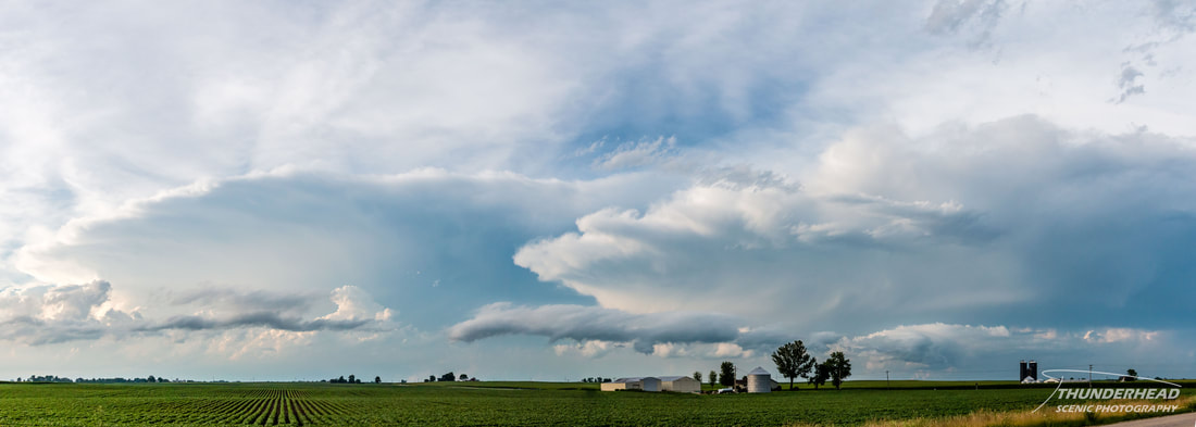
I pulled off on a back road just north of Peoria, took a few pictures (below), decided the day was over, and headed back home. I got home around 10:30pm and was able to see a ridiculous lightning display on the backside of the Hannibal storm I missed that was now north of Mt. Vernon, IL. That storm, as well as one that produced a tornado in Kansas were some of the better storms of the day. The storms that formed in central and northern Illinois were dull and didn't do what they were "supposed" to do. I was really hoping to be successful on this chase, as this is the first long distance chase I’ve done solo, but that’s just how chasing goes.